Community Feedback Sought on Draft Tumut Flood Study
Published on 06 November 2025
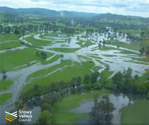
Snowy Valleys Council is encouraging community members to learn more about the newly drafted Tumut Flood Study and provide their feedback while the study is on Public Exhibition.
Council’s Acting Director Community, Corporate & Development Nick Wilton said the 2025 flood study has produced a set of updated models and outputs that council can confidently use for planning and emergency management.
“The feedback we hear from the community will be reviewed and considered in the finalisation of the Flood Study,” Mr Wilton said. “And once adopted by Council, we are committed to ensuring the outputs of the study are implemented’.
Interested community members can access the draft study and provide feedback online via the council’s website.
Mr Wilton added ‘As part of Council’s communications strategy, Council has recently sent text messages to community members within the catchment area to raise awareness of the study and outline how the community can get involved’
For those who would like to learn more about the study and speak with staff and WMA Water representatives, two community pop-up sessions are also being held in mid-November.
- Thursday 13 November @Club Tumut - 4pm to 6pm
- Friday 14 November @Club Tumut - 10am to 12noon
Mr Wilton said the Study establishes an Interim Flood Planning Area (FPA) and Flood Planning Level (FPL) to guide future development.
“It also provides detailed mapping of property and road inundation, flood emergency response classifications, and estimates of potential economic damages,” Mr Wilton explained.
“The Study confirms that significant flood risks remain from the Tumut River, Goobarragandra River, Gilmore Creek and local overland flows, with depths up to 9 metres possible in extreme events, and identifies climate change as a key driver of increased future risk.”
In late 2023, residents had the opportunity to provide important feedback and data on their experiences with flooding to help inform the flood study review. The data was collected through a questionnaire/survey and a community information drop-in session held in Tumut.
The project is supported by the NSW Government’s Flood Risk Management Program (FRMP), which aims to reduce the impacts of flooding and flood liability on individual owners and occupiers, and to minimise private and public losses resulting from flooding. Under the Program, local government is responsible for managing flood liable land.
All Councils are required by the NSW State Government to undertake studies to determine what land has the potential to be affected by flooding. This is to ensure that new developments are adequately protected and do not make flooding worse for existing development.
For more information, visit www.svc.nsw.gov.au/public-exhibition
-ENDS-